AnHuNav
Forschende:
Interdisziplinarität setzt Impulse

AnHuNav
Animal and Human Navigation in Antiquity - AnHuNav
Full Project Title
AnHuNav – Animal and Human Navigation in the Ancient Southern Levant: An Interdisciplinary Project on Spatial Perception, Route Formation, and Orientation between Environmental Knowledge and Textual Tradition (Iron Age to Roman Imperial Period)
Participating Faculties: IV and V
Project Leaders:
Dr. Pauline N. Fleischmann (Faculty V)
Prof. Dr. Benedikt Hensel (Faculty IV)
Prof. Dr. Torsten Jantsch (Faculty IV)
The Idea in a Nutshell
Were animals in antiquity, through their migratory movements, the forerunners of modern navigation systems—guiding humans along their paths? This is the question explored by the Impulse Group “Animal and Human Navigation in the Ancient Southern Levant.” The project brings together, among others, perspectives from Biblical Studies and Biology.
Ancient Jewish, Greco-Roman, and Christian texts contain numerous references to animal navigation. Philosophers and natural scientists of antiquity had already developed theories on how animals orient themselves, for example by using celestial information.
The project investigates how far knowledge of animal navigation shaped human behaviour in antiquity, especially among populations in the southeastern Mediterranean region around Israel, Jordan, and Lebanon. This includes on-site studies that also take into account current migration patterns of birds and mammals.
A key aim of the project is the development of a computer-based model visualising major ancient trade and communication routes in the region, along with the environmental and cultural factors that influenced them.
Project Description
Understanding Navigation before GPS
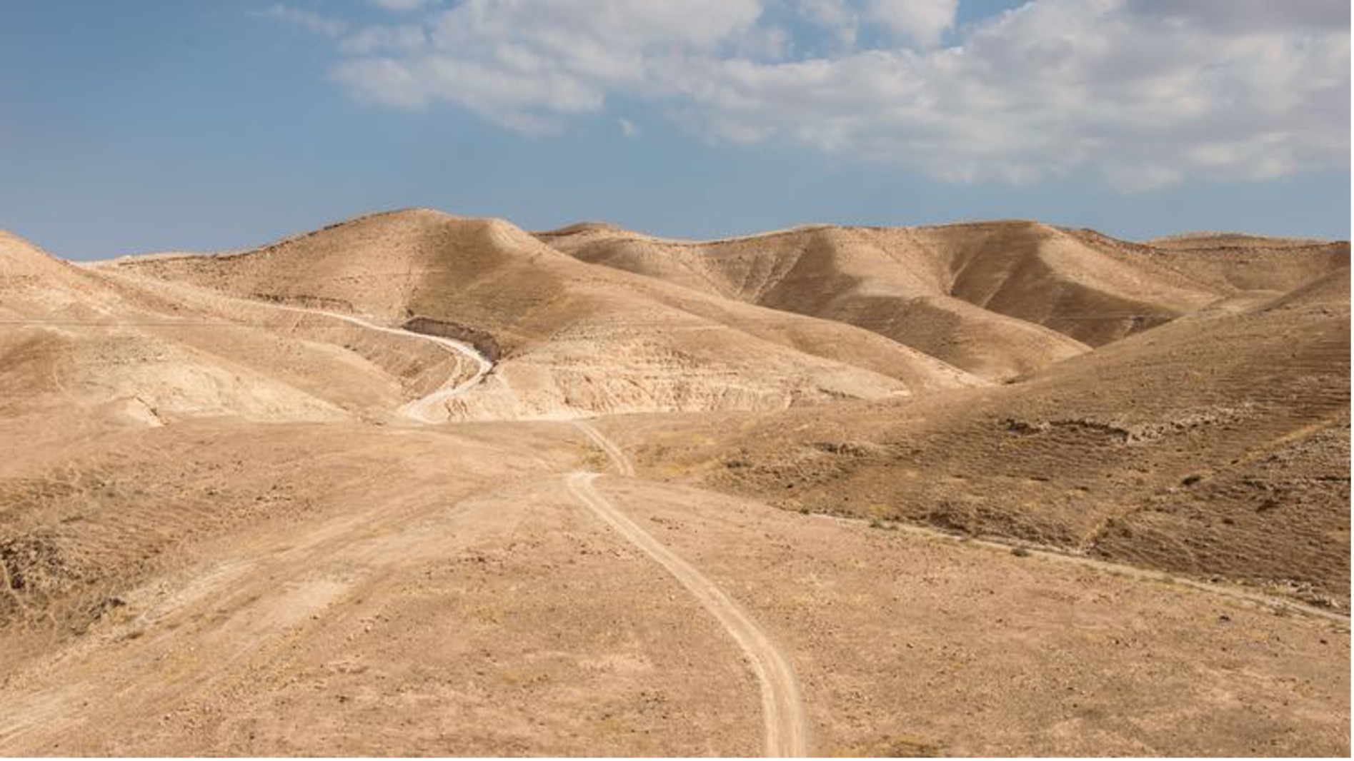
AnHuNav – Animal and Human Navigation in the Ancient Southern Levant examines how humans and animals perceived, navigated, and shaped ancient landscapes in a region of pivotal cultural, economic, and geopolitical importance—between Egypt, Arabia, Mesopotamia, and the Mediterranean.
Despite growing scholarly interest in ancient mobility and trade networks, systematic investigation into the connection between human navigation and animal movement has been lacking. Yet archaeological surveys, textual sources, and ethnohistorical observations suggest that routes established by migratory animals—such as birds, ungulates, and camels—often provided the foundations for later human pathways.
The overarching goal of AnHuNav is the rediscovery of ancient cultural techniques of orientation and navigation, grounded in environmental perception and the observation of animals. By integrating perspectives from Biblical Studies, Ancient History, Archaeology, Biology, and Digital Archaeology, the project aims to reconstruct how these techniques informed both textual traditions and concrete mobility patterns. Ultimately, the results will be translated into computational models that validate ancient routes and develop a functional framework of “navigation without GPS.”
Research Area 1: The Cultural Representation and Perception of Animal Navigation in Ancient Texts
Research Area 1, supervised by Prof. Dr. Torsten Jantsch and Dr. Pauline N. Fleischmann, focuses on the representation of animal navigation in ancient Jewish, Greco-Roman, and Christian literature. Ancient texts—from the Hebrew Bible and Hellenistic philosophers to early Christian writings—contain frequent references to animals’ ability to orient themselves. Examples include birds as symbols of return and renewal, camels and donkeys finding water in arid zones, or doves used for communication.
Philosophers and naturalists such as Aristotle, Pliny, and Aelian developed theories about animal navigation, highlighting sensory capacities, celestial knowledge, and environmental awareness. Ancient authors often drew analogies between animal and human navigation, embedding these insights in geographical accounts, itineraries, pilgrimage narratives, and even maps.
For the first time, these traditions will be systematically catalogued and analyzed within their historical, environmental, and religious contexts. The outcome will be the first comprehensive cultural-historical study of animal navigation and its reception in antiquity, with particular emphasis on the Southern Levant and the Eastern Mediterranean.
Research Area 2: The Archaeology of Trade and Pilgrimage Routes in the Southern Levant
Research Area 2, supervised by Prof. Dr. Benedikt Hensel and Dr. Pauline N. Fleischmann, builds on archaeological, topographical, and environmental data to reconstruct ancient trade and pilgrimage networks. The Southern Levant’s rich pathway system—from the Incense Road to Transjordanian mountain routes and desert tracks—is well documented through surveys and excavations. Yet environmental and zoological factors influencing these routes—animal trails, water resources, and terrain navigability—have not yet been systematically modelled.
Key examples include the adaptation of ancient animal trails for human travel, such as the difficult ascents to Jordanian hilltop settlements, or the desert routes made possible through camel-based transport. These case studies highlight how human infrastructure often aligned with pre-existing animal pathways.
The principal task of Research Area 2 is to develop a multimodal computer-based model of these routes, drawing on GIS techniques (least-cost path analyses, 3D terrain reconstructions), and integrating archaeological, textual, hydrological, and zoological data. In collaboration with geovisualisation and AI specialists at Jade University of Applied Sciences, the project aims to advance predictive modelling for ancient mobility.
Methodology and Innovation
AnHuNav combines:
- philological and cultural-historical analysis of ancient texts,
- cataloguing of travel descriptions, itineraries, and pilgrimage accounts,
- GIS-based spatial and digital archaeology,
- ethnoarchaeological surveys in Israel and Jordan,
- biological and ethological studies of animal navigation,
- interdisciplinary workshops integrating the humanities and natural sciences.
By weaving together textual, archaeological, and biological perspectives, the project pioneers a transdisciplinary approach to ancient navigation.
Cooperation with German Protestant Institute of Archaeology (DEI) Jerusalem, Israel
From 2027 onwards, the project will be carried out in close cooperation with the German Protestant Institute of Archaeology (DEI) in Jerusalem, whose designated director is Prof. Benedikt Hensel. This partnership provides access to local research data, field sites, and enables on-site investigations in Israel and Jordan—anchoring AnHuNav within the living landscapes it seeks to study.
Background
The Carl von Ossietzky University is receiving 22.5 million euros from the Ministry of Science and Culture (MWK) and the Volkswagen Foundation from the “Strategic Development of Potential” funding line to sharpen its profile and strengthen its national and international competitiveness through the project “A Programme for Excellence. Developing Strengths and Building Potentials by Interdisciplinary and International Networking.” Among other things, this is to be achieved through consistent networking across national and international borders, the promotion of students and scientists in early career phases and the strengthening of interdisciplinary research priorities in socially relevant and innovative areas.