


More rain in the winter, droughts in the summer: the climate is changing in the north-west of Lower Saxony. In the WAKOS project, environmental and social science researchers from Oldenburg are investigating ways to adapt to these changes.
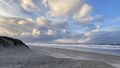
The trek across the North Sea island of Norderney is around five kilometres long. Designed by Oldenburg researcher Lena Thissen together with a social scientist from the University of Hamburg, the "Freshwater Lens Walk" is all about a hidden treasure: the island's freshwater supply. The walking tour begins at the waterworks at the island's centre then leads to a well in the middle of a barren dune landscape and on to a wet dune valley overgrown with trees and sedges. The last two stops are on the beach, where fresh water flows into the sea and the sharp ridges of the dunes showcase the effects of erosion. "The aim of the tour is to bring the island's freshwater lense to life – and show how climate change is endangering this valuable resource," explains hydrogeologist Prof. Dr. Gudrun Massmann, in whose research group Thissen completed her doctorate.
The Freshwater Lens Walk will be offered as a guided tour for holidaymakers and people who live on the island. It emerged from the WAKOS (Water on the East Frisian Coast) project funded by the Federal Ministry of Research, Technology and Space (BMFTR). Since 2020, researchers from five partner institutions led by the Helmholtz-Zentrum Hereon in Geesthacht have been studying the natural hazards that the East Frisian coastline and the offshore islands face as a result of climate change – and how society can adapt to the changing conditions. The second phase of the project began around a year ago. In addition to Massmann and her team from the Hydrogeology and Landscape Hydrology research group, Oldenburg scientists from the Ecological Economics research group led by Prof. Dr. Bernd Siebenhüner are also involved in the project.
Freshwater lens fed by rainwater
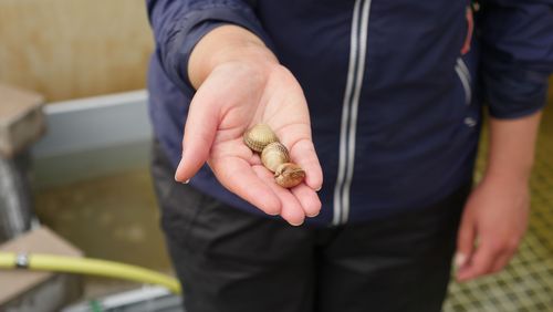
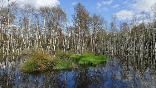
"The Freshwater Lens Walk is a wonderful initiative and highlights the productiveness of the interdisciplinary collaboration within the project," says Siebenhüner. The guided tour presents scientific findings in a way that everyone can understand: participants learn how freshwater is deposited in the island's sandy subsoil, where it forms a lenticular layer up to 80 metres thick that is fed by rainwater and essentially "floats" above the salt water of the deeper layers. They learn that the drinking water requirements of the island's residents and visiting tourists are covered by this reservoir in its subsurface. "You can actually see the surface of the freshwater lens in the wet dune valleys. This is where the groundwater comes to the surface, which allows a special combination of flora and fauna to develop here," Massmann explains.
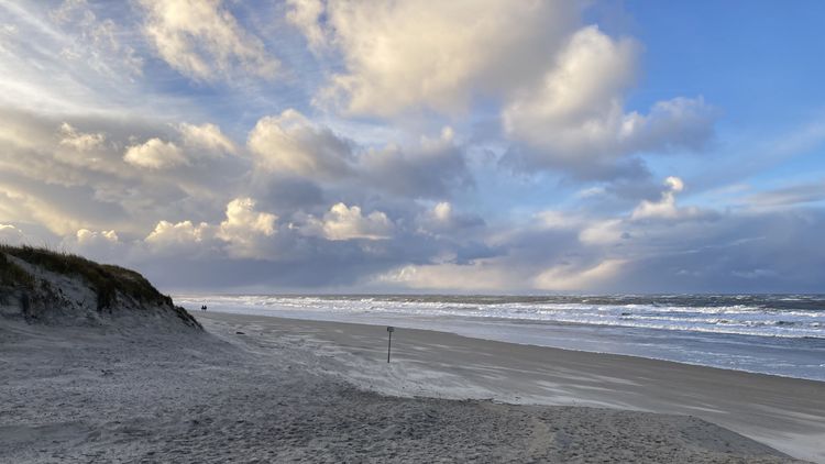
Participants in the walk can also observe the consequences of climate change: at the last stop on Weiße Düne (White Dune) beach, a two-metre drop-off has formed along the edge of the dunes. "Storm surges have washed away a substantial amount of sand here in recent years," Lena Thissen points out. Climate change is exacerbating the phenomenon: the sea level around Norderney has risen by approximately 16 centimetres over the last one hundred years and could rise by another 80 centimetres by the end of this century. Extreme water levels are consequently ever more frequent. This also has an impact on the freshwater lens, Thissen explains: "When the dunes erode on the seaward side, the area under which freshwater can spread out shrinks, which means that the drinking water volume also decreases."
Patrick Hähnel, a doctoral candidate in Massmann's team, used numerical modelling to simulate what will happen to the lens over the coming decades. According to his model, the freshwater supply will shrink by ten to fifteen percent by the end of the century, depending on the climate scenario. "The calculations also show that as the sea level rises, groundwater levels will also increase," explains Massmann. This means that in future not only some of the dune valleys, but also low-lying areas of the town and airport on Norderney could be flooded on a regular basis in the winter. "Our modelling was focused on the problem of salinisation, but our results show that rising groundwater levels in winter may in fact pose a bigger problem for the island," says the researcher.
The coastal region will be particularly hard hit."
Bernd Siebenhüner
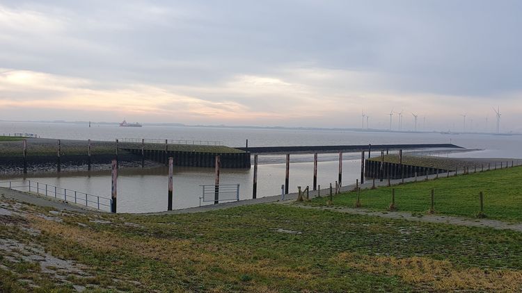
In addition to Norderney, the WAKOS project also focuses on the municipality of Krummhörn and the nearby town of Emden. In the coming years, storm surges, heavy rainfall, groundwater salinisation and droughts are also likely to cause problems further inland in East Frisia. "The coastal region will be particularly hard hit by climate change," says environmental economist Siebenhüner. One scenario investigated by the researchers as an extreme outcome in the first phase of WAKOS already became reality over the Christmas period in 2023: the month of December saw heavy, continuous rainfall followed by several storm surges. Sluices on the coast and the Hunte Barrier in Elsfleth remained closed, and the pumps were unable to sufficiently drain the inland areas due to the elevated water levels. As a result, the water backed up, rivers burst their banks and large swathes of Lower Saxony were flooded.
The question of how East Frisia can protect itself against such events is not just a matter of technical solutions, but also society's ability to adapt – in orther words, whether the state, the local authorities, the water management authorities, the sluice management authorities and other stakeholders will be able to implement the necessary measures. Siebenhüner and his team are researching this in workshops and interviews with local and regional stakeholders. "We are interested in how well the various stakeholders are networked, how close the dialogue is across different levels, and where the challenges or potential conflicts lie," says Lara Saalfrank, a research assistant in the project. One of the team's findings is that the planning and decision-making structures in Lower Saxony are highly fragmented, for example in the areas of regional planning and inland drainage. These structures, which have evolved over centuries, make climate adaptation more difficult.
Interests must be carefully weighed against each other
The team sees the greatest potential for conflict in decisions that pertain to land use. According to the hydrogeological model calculations, among other measures it would make sense to designate more land as retention and polder areas and to dig drainage ditches less deep in order to retain precipitation in the landscape for longer. This would not only help local populations to cope better with droughts, but would also slow down the underground salinisation of groundwater by seawater, according to findings from the predecessor project SALTSA. However, wet and rewetted areas often conflict with agricultural interests and flood protection measures. One potential way to deal with storm surges is a controlled opening of dykes in certain areas – for example in front of flood polders or retention areas – to limit flooding in other regions. But which areas are suitable for this? "All these strategies – from adapted drainage mechanisms to more flexible coastal protection – require long-term and forward-looking planning in which different interests must be carefully weighed against each other," emphasises Ernst Schäfer, a research associate in the Ecological Economics research group.
WAKOS is keen to ensure that its research results can be applied in the project region of East Frisia. In the second project phase, a Climate Adaptation Academy offering online training as well as lectures, events and in-person courses is also being launched. The first workshops, in which the researchers will discuss their findings about the freshwater lens with local authorities, are due to take place on Norderney this autumn. "Making the findings of our modelling usable for local stakeholders is an important part of the project," Massmann underlines. One thing is clear, he says: "We need to make many adjustments in order to optimise water management in the marshes and on the islands and make it future-proof."