-

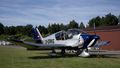
The test flight of the Migration Ecology working group took off from Varrelbusch Airport, which is located near Cloppenburg. Universitaet Oldenburg
Tracking birds, bats and bugs
In order to protect migratory animals, we need to know their flight routes. For a long time, however, smaller species such as songbirds were difficult to track. The Migration Ecology research group headed by Professor Heiko Schmaljohann uses tiny radio transmitters and fixed radio receiving stations that are part of a worldwide network to track animals over long distances. In a unique experiment carried out last summer, the researchers used an aeroplane to assess just how precisely migratory routes can be estimated on the basis of radio recordings. A picture story.
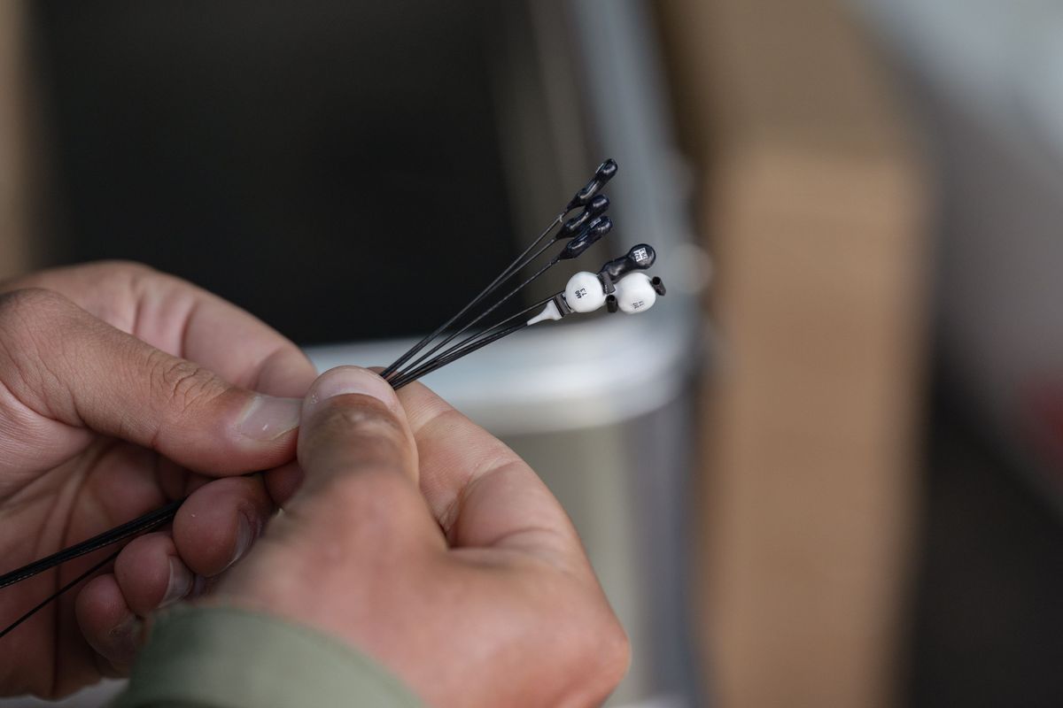
To track the routes of small species such as bats, songbirds and even insects, researchers use radio transmitters that weigh as little as 0.1 to 2.6 grams. These are carefully attached to the birds’ backs using elastic bands to avoid impeding their movement. Each transmitter emits
a unique radio signal every few seconds that allows the carrier to be identified and tracked individually. After a few weeks, the transmitters generally just fall off.
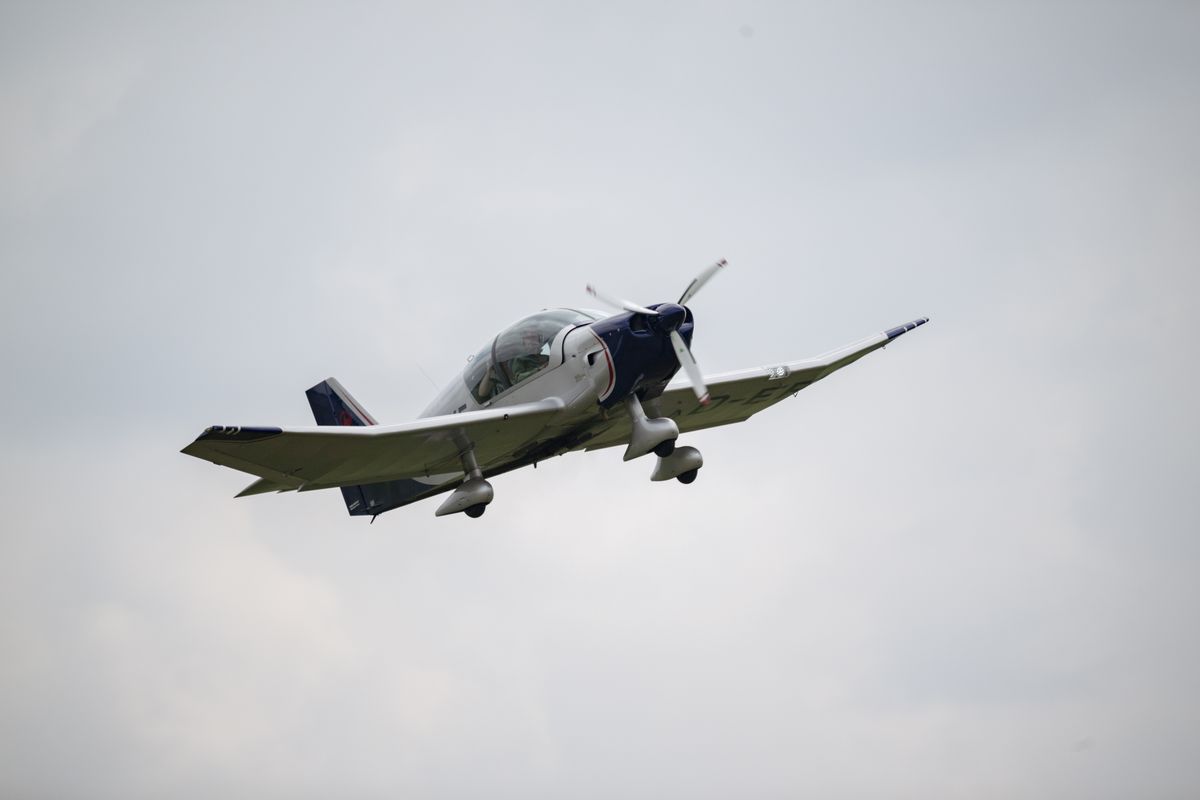
During the experiment conducted by the Migration Ecology research group in July, it was not a bird but an aeroplane that took to the air. It took off from Varrelbusch Airfield in the district of Cloppenburg, near Oldenburg.
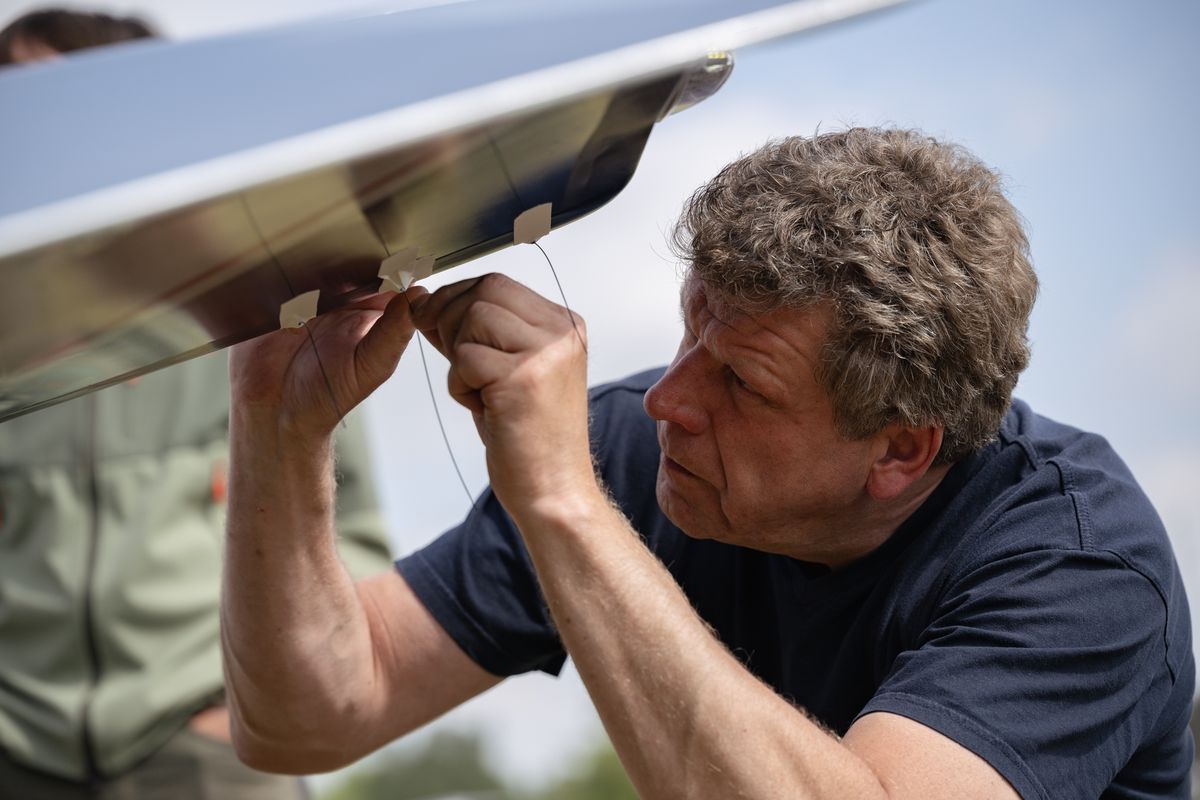
The researchers – pictured here: technician Mario de Neidels – attached a total of six radio transmitters to the plane’s wings and undercarriage. The aim of the experiment was to calibrate the transmitters by comparing the flight route estimated by the transmitters’ signals with the flight route identified by GPS in the aeroplane.

The researchers used tear-resistant tape to attach the transmitters. The batteries in the tiny devices have a lifespan of a good four weeks.
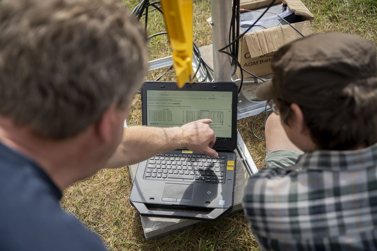
Before take-off, Dr Thiemo Karwinkel checks whether the transmitters are operational and emitting signals.
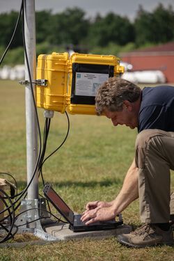
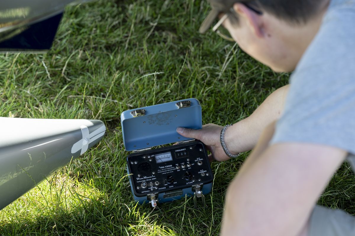
For the test flight, the Oldenburg team set up a temporary receiving station at the airfield. Together with around 60 fixed stations along the North Sea coast, it formed part of the Motus Wildlife Tracking System, an international collaborative research network that tracks the migra-
tion routes of small moving animals. The receiving stations consist of directional antennas on masts that are up to ten metres high. They can receive radio signals from a radius of five to twenty kilometres.
Each receiving station has a tech case containing a robust radio receiver. During the experiment, the researchers tested how the signal changed when the plane flew past and, for example, whether its wings interfered with transmission
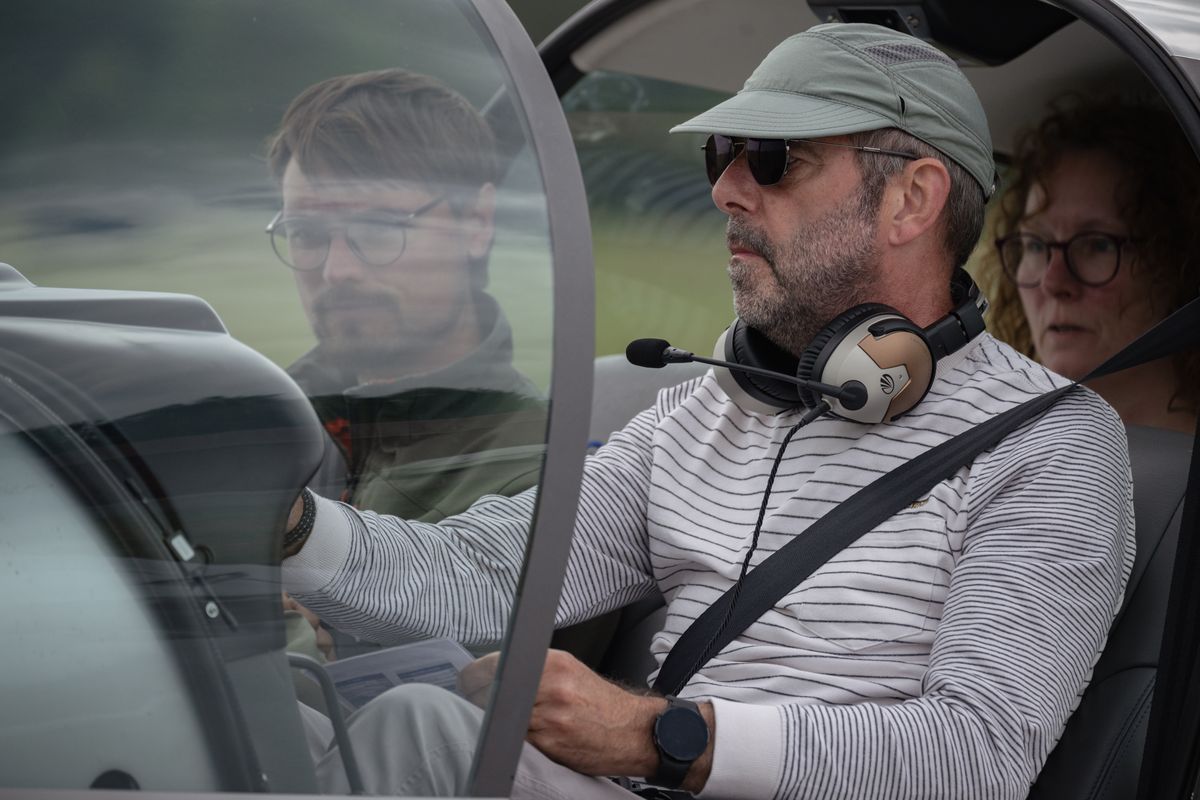
Final preparations before take-off: pilot Renke Schütte programmes the flight route. On board with him are doctoral student Georg Rüppel and technician Melanie Willen.
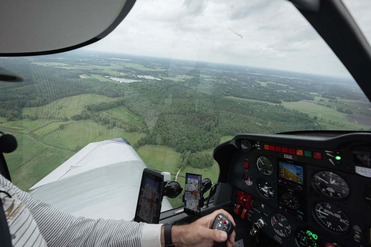
During the test flight, the plane flew over a Motus network receiving station located in the Wold woodlands, west of Oldenburg. Wold Lake can be seen in the background.
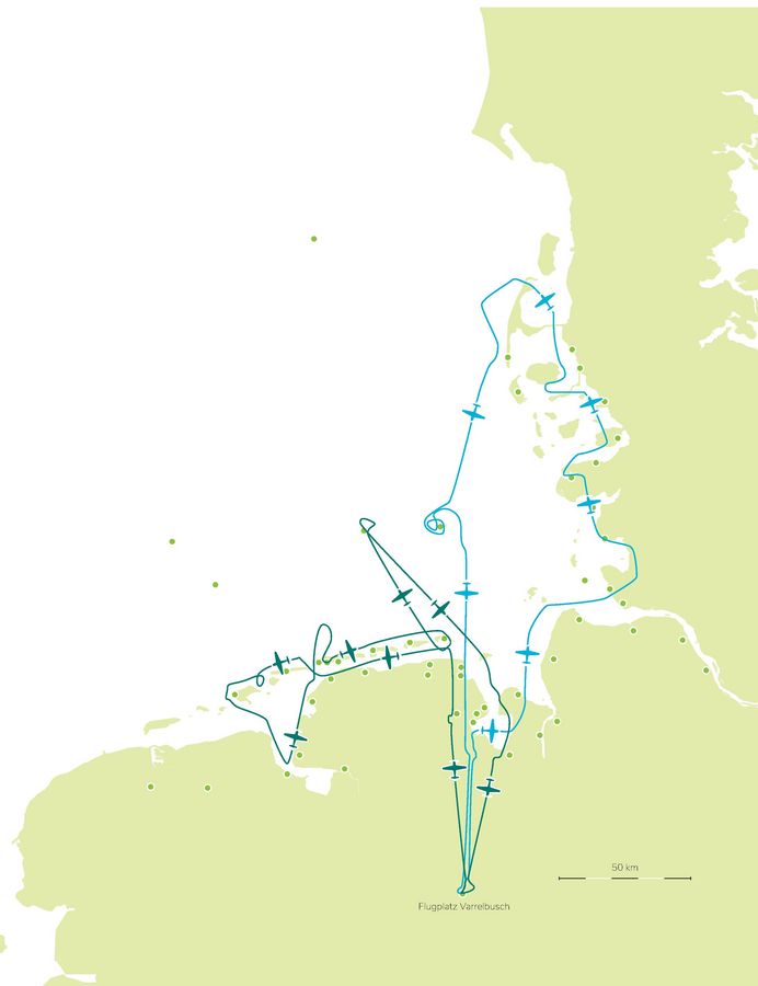
For the experiment, the team spent two days following typical bird migratory routes along the North Sea coast, flying past numerous receiving stations of the Motus network (green dots). The team first flew along the west coast of Schleswig-Holstein, made a stopover on the island of Föhr, then flew to the islands of Sylt and Helgoland and back to Varrelbusch. In its second flight, the plane flew over the Jade Bight and the East Frisian Islands to the seaport of Emden, taking a detour to a light vessel in the North Sea. Doctoral student Georg Rüppel will use the collected data to create a model for estimating the flight paths of the radio-tagged animals more reliably. The
researchers want to be able to track, for example, small migratory birds at night and determine whether they are more likely to pass through or avoid wind farms.

Topics
- Astronomy
- Biology
- Botanical garden
- Chemistry
- Computing Science
- Cooperations
- Covid
- Culture
- Dutch Studies
- Early Career
- Economics
- Educational Sciences
- Energy
- Energy Research
- Environmental Sciences
- Equal opportunities
- German Studies
- Graduate academy
- Health Services Research
- Higher Education Policy
- History
- Human Medicine
- International affairs
- Marine Sciences
- Material Culture
- Medical ethics
- Medical Physics and Acoustics
- Music
- Neuroscience
- People
- Philosophy
- Physics
- Presidential Board
- Psychology
- Research
- Slavic Studies
- Social Sciences
- Special Needs Education
- Sport Science
- Study Affairs
- Sustainability
- Teacher Education
- Theology
- Transfer
- University Medicine
- Ukraine
- Wind Physics